



Shoreline Stabilization Project
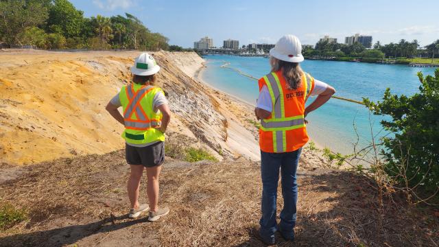
In northern Palm Beach County on Florida’s urbanized Treasure Coast lies the 120-acre Jupiter Inlet Lighthouse Outstanding Natural Area (ONA). The ONA was designated by Congress in 2008 for the preservation, protection and enhancement of seven key resources and values found on the site; these include the remarkable biodiversity and rich history of the site. The site is the only unit of the National Conservation Lands east of the Mississippi River, and the only unit managed by the BLM’s Eastern States.
On March 24, 2025, the Bureau of Land Management broke ground on a critical infrastructure project to protect and enhance the iconic Jupiter Inlet Lighthouse and unique, significant resources of surrounding public lands. The community, local elected officials, and special guests joined BLM officials in celebrating the $16 million effort to stabilize the shoreline and incorporate resilient recreation features at the ONA.
With an investment of $8.3 million from the Great American Outdoors Act and $7,000,000 in support from the Florida Inland Navigation District, the project will add engineered and living shoreline components to reduce erosion and sediments entering the Intracoastal Waterway.
Project Description
Covering about 5 acres, the project includes construction of a retaining wall, installation of in-water wave breaks, pilings, artificial reef structures, and an addition of shoreline access points. The planting of upland and tidal vegetation, including mangroves, will enhance and protect the area’s terrestrial and marine habitats.
Project Timeline

Benefits
The ONA Shoreline Stabilization Project significantly enhances public safety by preventing erosion and protecting coastal infrastructure. Improved shoreline stability will ensure safety for boaters and shoreline users at the ONA and within the adjacent intracoastal waterway, reducing hazards to navigation. Additionally, the project enhances recreational opportunities by preserving the natural landscape, allowing for continued enjoyment of outdoor activities such as fishing, kayaking, and wildlife observation in a safer environment.

- The Challenge
The ONA is losing approximately 7 feet of shoreline each year due to severe erosion, threatening the historic lighthouse structure and surrounding natural habitats.
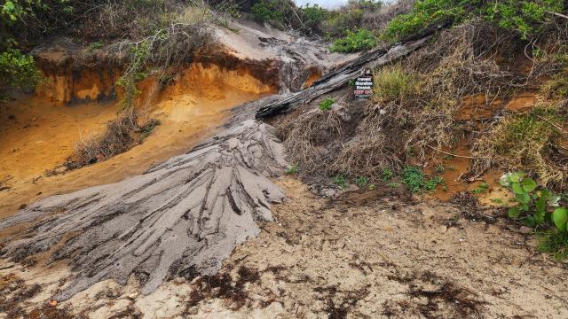
Erosion of the shoreline evident prior to construction mobilization. Ongoing erosion poses significant threats to:
- The historic Jupiter Inlet Lighthouse
- Critical natural habitats within the 120-acre ONA
- Safe navigation on the Intracoastal Waterway
- Public safety along the shoreline
Without intervention, continued erosion will result in potential structural damage to the lighthouse, loss of protected natural areas, and disruption to maritime activities in this historically and ecologically significant area.
- The Solution
The BLM and its state and local partners are taking action to protect and enhance the shoreline at the ONA for all to enjoy now and into the future.
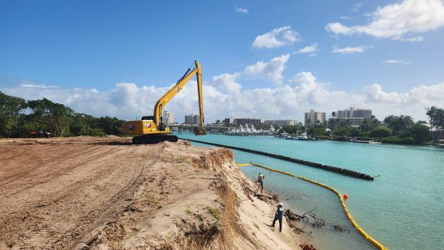
A long-reach backhoe removes overhanding sediment from the shoreline ready for installation of the lower portion of the retaining wall. Project Scope:
- Stabilize approximately 5 acres or 1 mile of eroding shoreline
- Timeline: January 6, 2025 to October 2026
- Total Budget: $16 million
Funding Sources:
- Great American Outdoors Act (GAOA): $8.3 million
- Florida Inland Navigation District (FIND): $7 million
- Additional sources: $0.7 million
Implementation Methods:
- Engineered structures: Rip-rap wave breaks, retaining walls, terraced seawalls
- Living shoreline techniques: Native vegetation planting, mangrove restoration
- Creation of salt marsh habitat and artificial reef structures
- ADA-compliant recreational amenities
- Public Safety & Navigation Benefits
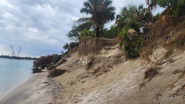
Erosion of the shoreline evident prior to construction mobilization. - Eliminates falling vegetation and collapsing sand
- Stops vegetation debris in the waterway creating hazards to boating
- Reduces sediment entering the intracoastal waterway, and therefore reduces a portion of the required routine dredging to maintain navigability
- Adds navigational aids to support use of the Intracoastal waterway.
- Recreational Enhancements
New Public Access Features:
- New approximately 700-foot public boardwalk along the Loxahatchee River
- Construction of approximately 800-foot terraced wall with 9 stairways for improved shoreline access
- Enhanced snorkeling and marine education areas
- New dock facility for ferries and water taxis
Accessibility Improvements:
- ADA-compliant dock and access improvements
- Improved access points to the Loxahatchee River & Indian River Lagoon
- Dedicated boat access spots with access to the ONAs trail system
- Safer recreational areas for visitors of all abilities
- Enhanced educational opportunities about coastal ecosystems
Note: Boat beaching spots will be reduced during construction.
- Economic Benefits
Tourism and Heritage Protection:
- Safeguarding the Jupiter Inlet Lighthouse, a major tourist attraction
- Preservation of a historic site that generates approximately $14.7 million annually for Palm Beach County
- Protection of a site that draws over 150,000 visitors per year
Economic Development and Navigation:
- Protection of the Intracoastal Waterway's navigability for commercial and recreational vessels
- Job creation through Great American Outdoors Act funding
- Reduced long-term maintenance costs for waterway dredging
- Support for local maritime businesses and recreation industries
- Environmental Considerations
Habitat Creation and Enhancement:
- Planting of 10,000 new mangroves
- Creation of 2-acre salt marsh habitat
- Installation of artificial reef structures
- Protection of habitats for sensitive and endangered species
Erosion Control and Water Quality:
- Significant reduction in shoreline erosion rate
- Decrease in sediment flow into the Intracoastal Waterway
- Improved water quality in the Loxahatchee River
- Protection of the 120-acre ONA
- Construction Information
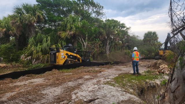
Roller-chopper clears vegetation to allow for installation of the gopher tortoise exclusion fencing. Project Timeline:
- Start date: January 6, 2025
- Completion: August 2026
- Phased approach to minimize disruption to visitors and wildlife
Visitor Impact During Construction:
- Wildlife protection measures in place, including gopher tortoise relocation
- Temporary trail rerouting of approximately 500-foot segment
- Intermittent closures of certain areas
- Limited boat anchorage accessibility during construction phases
- Informational signage and updates available on-site
Status & Milestones
Notice to Proceed issued to Dickerson Infrastructure this month, and Contract administration (scheduling, submittals, engineering reviews continue behind the scenes) begins behind the scenes.
Construction equipment and contractor will mobilize to the ONA, setting up temporary offices on-site. Vegetation salvage of herbaceous species for care at The Nature Conservancy Blowing Rocks Preserve is underway. The effort will save approximately 200 individual plants of a range of species to be returned to the site upon completion of the projects.
Gopher Tortoise exclusion fencing installed and tortoise relocations out of the construction zone underway this month. Turbidity curtain installation also to be completed this coming month to protect the Intracoastal waterway from any sediment generated by the project.
Clearing, Grubbing, other site preparations for the retaining wall area is completed.
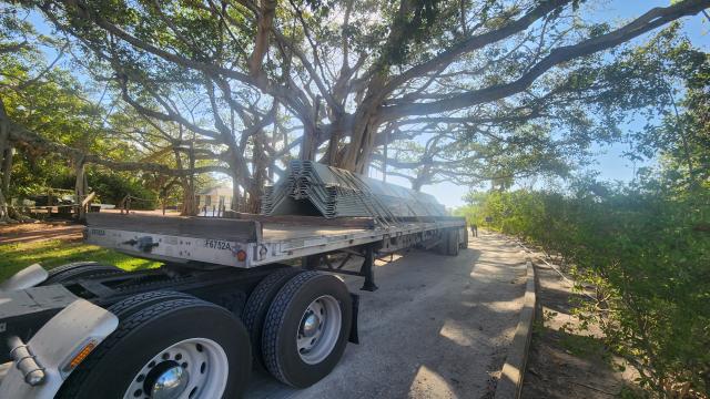
Sheet Pile is arriving throughout May and into June. Installation of the sheet pile should start before the end of the month.
The sheet pile retaining wall is approximately half-way complete.
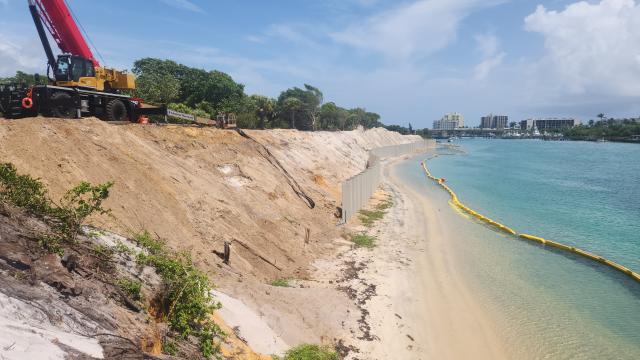
Touch up work has started on the sheet piles to ensure a complete corrosion resistant finish, and the final product has a clean uniform color.
First helical anchor performance test and the start of helical installation begins.

Begining formwork for concrete cap pouring.

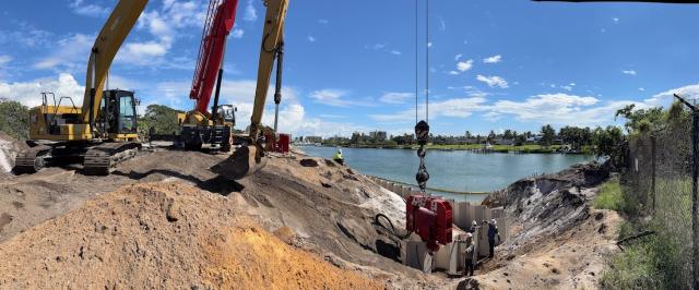
Turbidity curtain installation is complete to protect the Loxahatchee River from sediments generated by the installation of additional wave breaks along the site’s southern shoreline.
Sheet pile installation is completed.
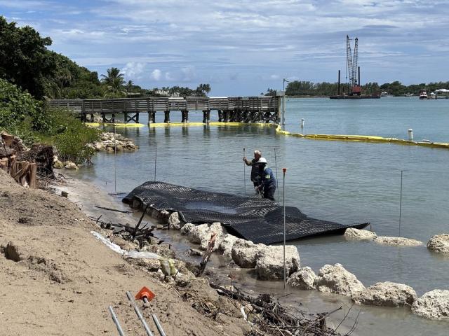
Bid option 2 breakwater installation completed. This area of work included the filling+leveling of a large grass event lawn, and the installation of two limestone breakwaters, putting this project area at 95% completion. The breakwater work is being completed by BDI Marine & Site Contractors, professionals are ensuring every limestone rock is placed down to have 3 points of contact and be aesthetically pleasing.
Last helical anchor of over 200 installed. Performance tests were completed every 9 anchors to ensure the wall is held in place.

Concrete cap pouring
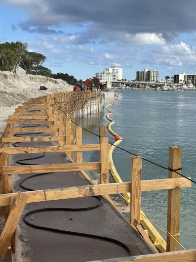
Remove formwork from concrete caps after curing via a drip hose for 7 days. This marks the final step in the sheet pile wall, allowing the construction of the gravity block wall to commence.
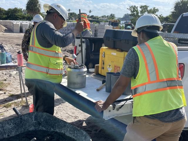
Begin construction of the gravity block wall, the upper of the two retaining walls being installed on site.
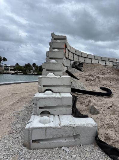
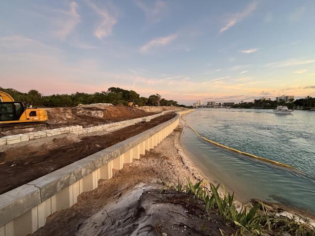
Instillation of the gravity block wall was completed.
Wildlife protected but not disturbed! Gopher tortoise near his burrow next to the construction site.

While the concrete was curing, backfill was compacted and tested. The backfill competent for the lower retaining wall was complete.
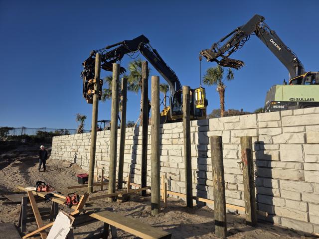
Begin installing stair piles that will allow for movement from the shoreline to the upper portion of the property.

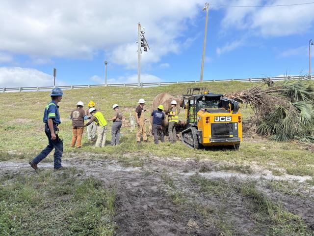
The first tree is planted on the shoreline! A mature Sabal palmetto, commonly referred to as a Cabbage Palm was installed on the upper retaining wall. This is the first of several hundred more plants to be installed along the 800’ construction site, plantings will mimic the ecosystems found on site.
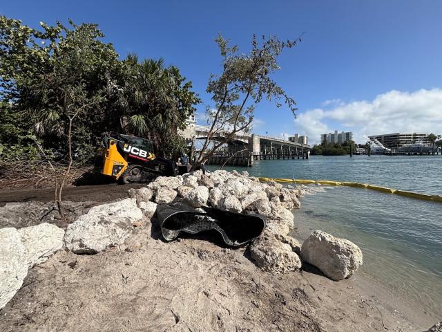
Work accelerated through winter and early spring.
- February 5: Representatives from the BLM Eastern States District visited the project site.
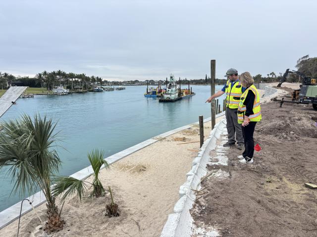
- February 24: Installation of the stair piles was completed.
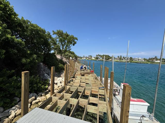
- March 16–17: America Strong began clearing and grubbing for the new boardwalk. A barge carrying the boardwalk pilings arrived the following day, allowing crews to begin leveling and shaping these foundational elements.
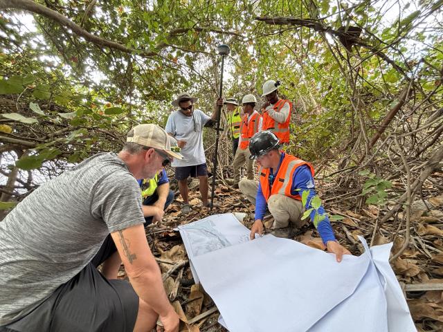
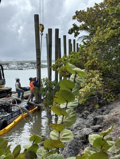
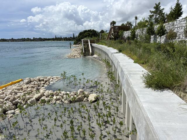
- March 25: The project celebrated its first mangrove planting in partnership with the MANG Foundation.
- April 1: The first batch of native plants was added at the north end of the site.
- April 15: Crews placed stone under the future boardwalk as part of shoreline protection work.
- April 20: Construction began on the Chickee huts, adding a historic and cultural dimension to the site.
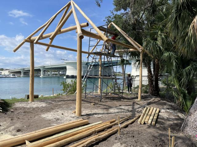
- April 28: America Strong continued progress by wrapping piles for the boardwalk.
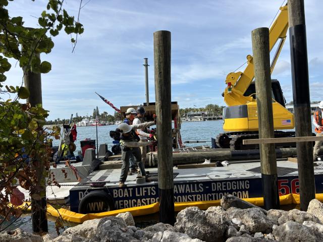
Work moved both landward and waterward.
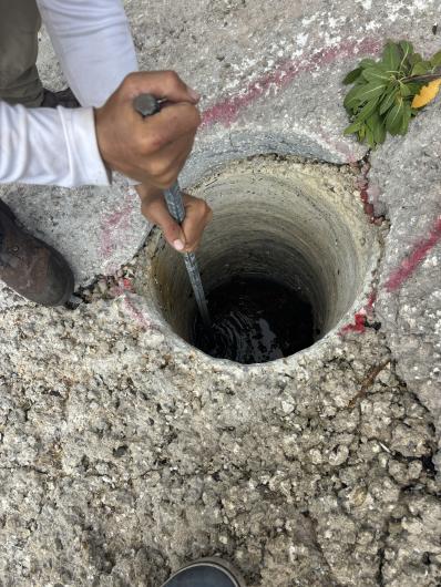
- May 22: Drilling began on the apron for boardwalk pile installation.
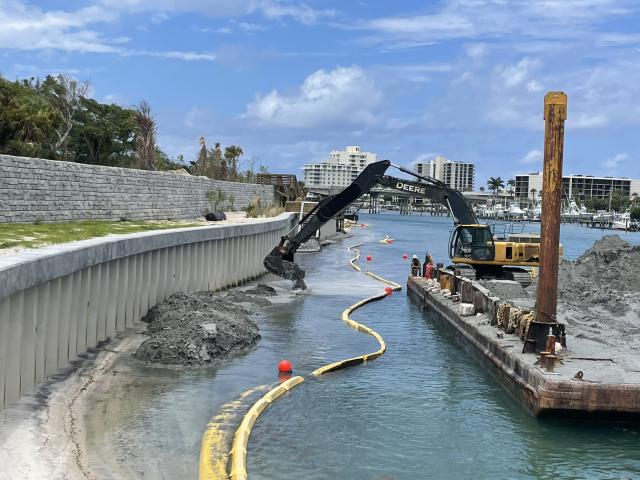
- June 4–6: Barge-placed sand was added to the beach in front of the sheet pile wall, helping reshape and stabilize the shoreline. Chickee construction was completed, and crews began installing joists and stringers on the boardwalk.
- June 26: A large-scale specimen tree planting took place with support from the EQI Environmental Group.
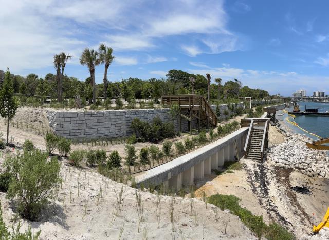
Community involvement and major structural milestones defined the summer.
- July 4: Volunteers joined the MANG Foundation for a mangrove planting event.
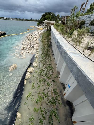
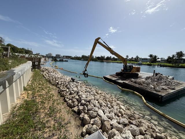
- July 31: The ADA-accessible pathway leading to the boardwalk and native plant trail neared completion.
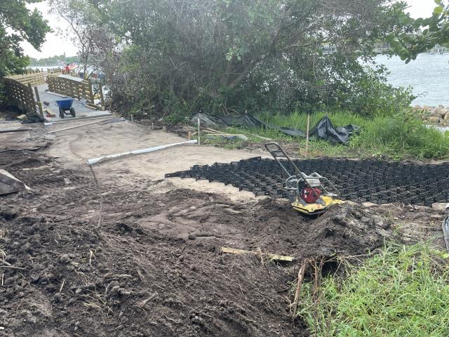
- August 20: The north-end boardwalk entered the final stretch of construction.
- August 30: Another round of mangrove plantings was completed behind one of the breakwaters.
Innovation and research joined restoration efforts.
- September 9: The first experimental Reef Arches™ structure was installed on the Loxahatchee River side of the property—marking the beginning of a new artificial reef system for ecological study and visitor enjoyment.
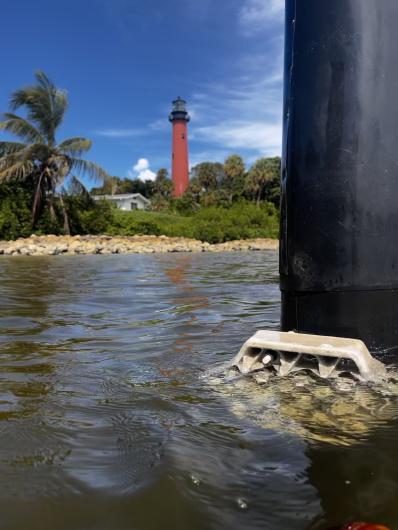
- September 10: In-water research teams deployed acoustic monitoring devices to track green sea turtles and other marine species moving throughout the waterways.
3-month Look Ahead
A grand opening celebration for the shoreline project is planned for December 3rd.
By winter:
- The historic corridor will be fully completed.
- The natural area will continue to host volunteer planting days to support habitat diversity and manage invasive species.
- The public will be invited to explore new beaches, hike additional miles of trail, and experience the water through snorkeling routes enhanced with experimental reef structures.