Wyoming Prescribed Fire
Fire has always been part of the environment, and one of the most important natural agents of change. Fire plays a vital role in maintaining healthy ecosystems. Native Americans understood this and used fire to hunt game, maintain rangelands, and keep forests healthy.
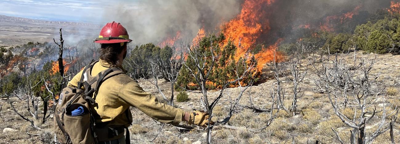
Prescribed fire is a planned fire. A prescribed fire is one of the most important tools used to reduce wildfire risk to communities, restore habitats, and to achieve land-management objectives. Fire management specialists consider objectives such as public and employee safety, weather, topography, fuels, size, the precise environmental conditions under which it will burn, and conditions under which it may be suppressed.
Prescribed fire is generally less expensive and yields ecological benefits that cannot be achieved by other means, such as mechanical thinning or logging. Prescribed fires restore some of the ecological benefits that were historically gained from naturally occurring fires. There are many potential goals that can be achieved by using prescribed fire. Here are a few examples:
- Reduce surface and ladder fuels that contribute to increased risk of uncharacteristically severe wildfire.
- Reduce risk local communities from wildfire.
- Help protect natural resources such as timber and critical habitat.
- Promote native species and reduce encroachment of invasive species.
- Enhance landscape resiliency and recovery from a wildfire event.
- Improve firefighter ability to safely and effectively respond to and suppress wildfire.
Prescribed Fires by District
All prescribed burns are carefully planned and only carried out when weather, fuel conditions, and air quality are within safe parameters. Firefighters use a combination of natural features and constructed control lines to keep the fire contained, with protocols in place to minimize smoke impacts on nearby communities.
- High Desert District
The following slash-pile burns are planned for fall and winter.
- Morgan Creek Wildland–Urban Interface: About 30 miles northeast of Rawlins in the Seminoe Mountains. Crews will burn slash piles from hazardous-fuels work to reduce risks to nearby structures and deeded lands.
- Corral Creek: About 15 miles east of Riverside, along Barrett Ridge near Carbon County Road 660 and BLM Road 3404. Crews will burn hand-built piles from juniper-removal work in riparian and nearby upland areas.
- Wagonhound and One-Mile timber sales: Near Arlington along the Medicine Bow National Forest boundary. Crews will burn remaining machine-built slash piles from timber harvests on BLM lands. Wagonhound is south of the I-80 rest area; One-Mile is south of Arlington.
- Iron Mountain Fuels Treatment: About 10 miles north of Dutch John, Utah. Crews will burn hand-built slash piles across approximately 1,430 acres to improve forage in big-game winter range and reduce hazardous fuels.
- Bear River Conifer Encroachment: On the east side of Crawford Mountain, about 7 miles south of Sage Junction and 8 miles east of Randolph, Utah. Crews will burn remaining slash piles across approximately 900 acres to reduce fuels and protect sage-grouse and mule-deer habitat, nearby structures, and deeded lands.
- Porcupine: Along the Smiths Fork River, about 25 miles north of Cokeville and 12 miles south of Smoot. Crews will burn slash piles from a 2024 fuels and wildlife habitat project to improve habitat and reduce hazards near adjacent landowners.
- Commissary Ranches Wildland–Urban Interface: About 17 miles north of Kemmerer, west of County Road 306. Crews will burn piles across approximately 12 acres to remove encroaching conifers, ladder fuels and dead-and-down material near the ranches.
- South Fork Wildland–Urban Interface Timber Sale: About 23 miles north of Kemmerer, west of County Road 306 along the Bridger-Teton National Forest boundary. Crews will burn piles across approximately 73 acres to reduce fuels, improve wildlife habitat and reduce hazards near adjacent landowners.
- Spring Canyon Ranches Wildland–Urban Interface: About 19 miles north of Kemmerer, west of County Road 306. Crews will burn piles across approximately 6 acres to remove encroaching conifers, ladder fuels and dead-and-down material near the ranches.
- Tokewanna and Little West Fork Timber Sales: In Uinta County, west of County Road 271 near Tokewanna Estates. Crews will burn remaining machine-built slash piles from timber harvests on BLM lands. The Little West Fork site is about a mile south of the Tokewanna site.
- Dempsey Pre-commercial Thin: On Dempsey Ridge, about 10 miles northeast of Cokeville. Crews will burn slash piles across approximately 23 acres from a forestry and hazardous-fuels project.
- Burdick Fuels Treatment: About 10 miles west of La Barge, near the head of Burdick Creek on Miller Mountain. Crews will burn hand-built slash piles across approximately 155 acres to encourage aspen growth, improve forage in big-game migration corridors and reduce hazardous fuels.No prescribed fires are planned at this time.
- High Plains District
- Wind River/Bighorn Basin District
Cody Field Office
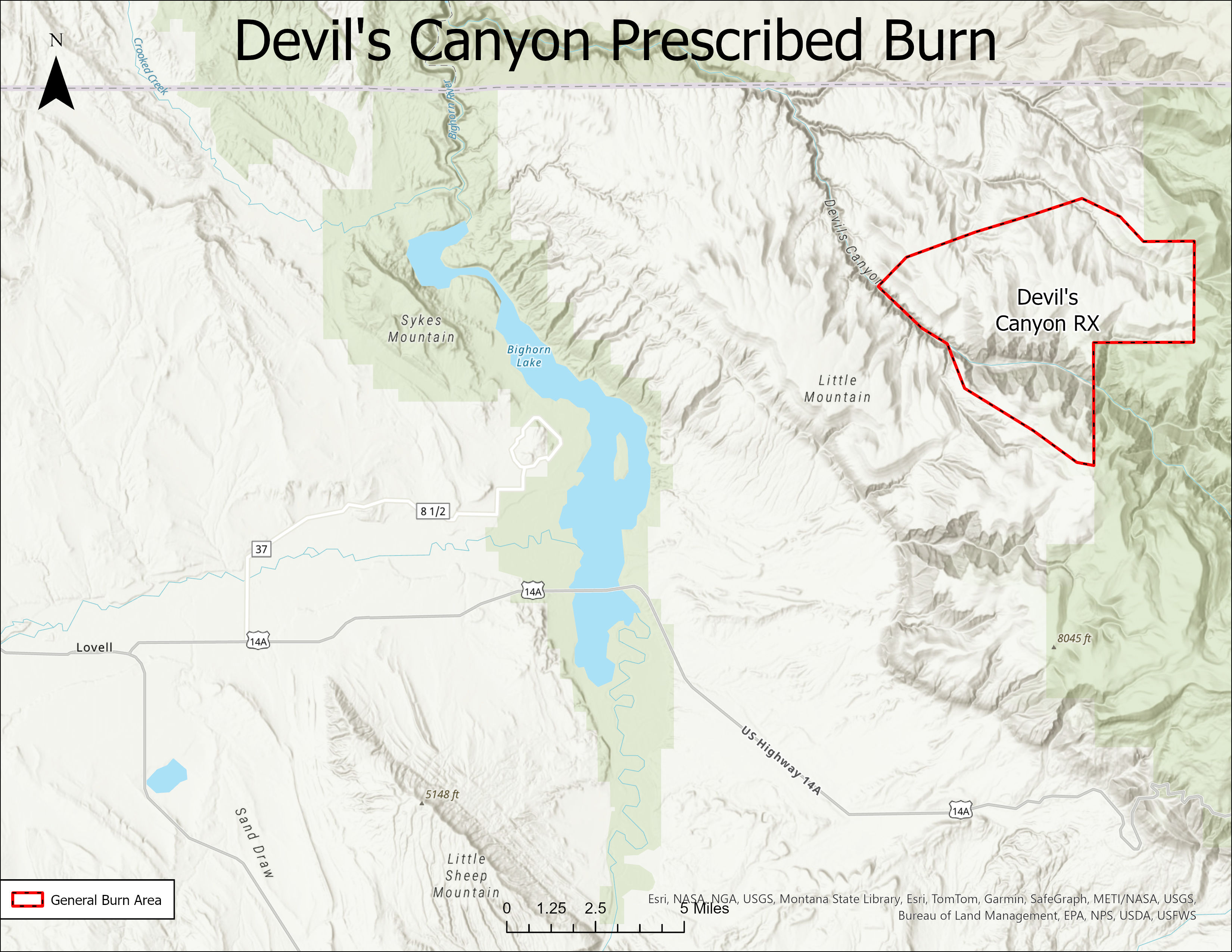
- Devil’s Canyon, twenty-five miles northeast of Lovel. Between October 31 and December 20. Approximately 200-500 acres of sagebrush, juniper, and grass vegetation will be targeted to enhance wildlife habitat.