


Oregon/Washington Prescribed Fire
Fire has always been part of the environment, and one of the most important natural agents of change. Fire plays a vital role in maintaining healthy ecosystems. Native Americans understood this and used fire to hunt game, maintain rangelands and keep forests healthy.
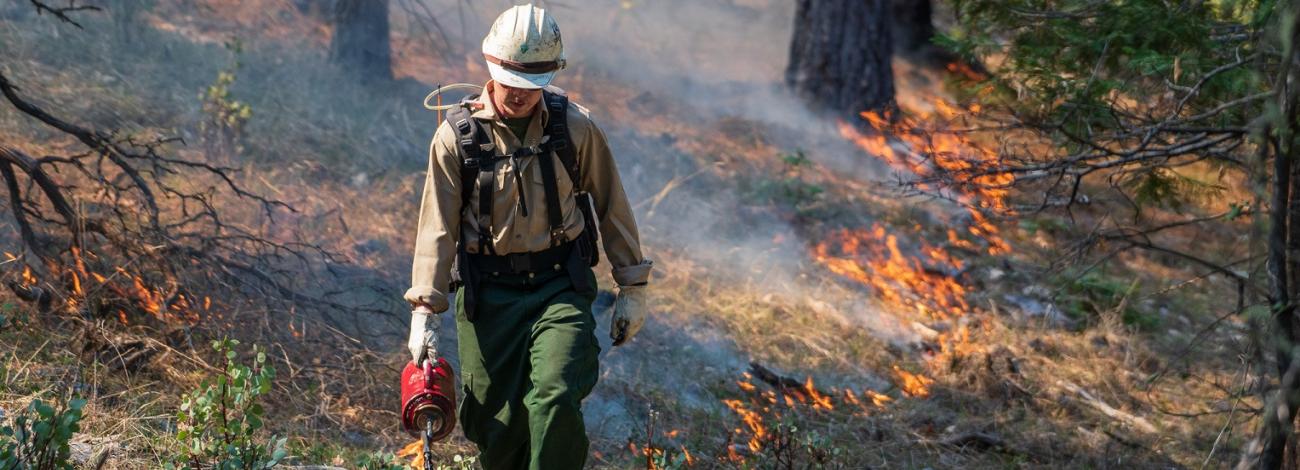
Prescribed fire is a planned fire. A prescribed fire is one of the most important tools used to reduce wildfire risk to communities, restore habitats, and to achieve land-management objectives. Fire management specialists consider objectives such as public and employee safety, weather, topography, fuels, size, the precise environmental conditions under which it will burn, and conditions under which it may be suppressed.
Prescribed fire is generally less expensive and yields ecological benefits that cannot be achieved by other means, such as mechanical thinning or logging. Prescribed fires restore some of the ecological benefits that were historically gained from naturally occurring fires. There are many potential goals that can be achieved by using prescribed fire. Here are a few examples:
- Reduce surface and ladder fuels that contribute to increased risk of uncharacteristically severe wildfire.
- Reduce risk local communities from wildfire.
- Help protect natural resources such as timber and critical habitat.
- Promote native species and reduce encroachment of invasive species.
- Enhance landscape resiliency and recovery from a wildfire event.
- Improve firefighter ability to safely and effectively respond to and suppress wildfire.
Prescribed Fires by District
All prescribed burns are carefully planned and only carried out when weather, fuel conditions, and air quality are within safe parameters. Firefighters use a combination of natural features and constructed control lines to keep the fire contained, with protocols in place to minimize smoke impacts on nearby communities.
- Burns
No prescribed fires are planned at this time.
- Coos Bay
No prescribed fires are planned at this time.
- Lakeview
Klamath Falls Field Office
Bryant Mountain (10 acres)
Timeframe: 11/26-03/27
Location: Hand pile burn 5 miles east of Malin, OR
Bonanza Cuttoff (354 acres)
Timeframe: 11/26-03/27
Location: Hand pile burn 5 miles east of Malin, OR
Stukel (10 acres)
Timeframe: 11/26-03/27
Location: Hand pile burn 1.5 miles northeast of Bonanza, OR
Goodlow Rim (150 acres)
Timeframe: 11/26-03/27
Location: Hand pile burn 10 miles southeast of Klamath Falls, OR
Bear Valley Refuge (300 acres)
Timeframe: 11/26-03/27
Location: Hand pile burn 15 miles east of Bonanza, OR
South DeVaul (20 acres)
Timeframe: 11/26-03/27
Location: Hand pile burn 3 miles south of Keno, OR
Lakeview Field Office
Mud Lake (2,609 acres)
Timeframe: 11/26-03/27
Location: 10 miles east of Adel
Hill Camp (865 acres)
Timeframe: 11/26-03/27
Location: 14 miles East of Adel
Picture Rock (3,380 acres)
Timeframe: 11/26-03/27
Location: Hand-pile burn approximately 5 miles north of Summer Lake, OR adjacent to Hwy 31
- Medford
No prescribed fires are planned at this time.
- Northwest Oregon
No prescribed fires are planned at this time.
- Prineville
No prescribed fires are planned at this time.
- Roseburg
Swiftwater Field Office
Timeframe: September–October 2026
Location: Douglas County, Oregon — North Bank Habitat Management Area, approximately six miles west of Glide, Oregon, off North Bank Road. The BLM plans to conduct a 122-acre prescribed burn beginning as early as September 29, 2026, if conditions are favorable. Local trail systems may be impacted, including the West Entrance parking lot, Blacktail Ridge Trail, Middle Ridge Trail, Chasm Creek Road, Thistle Ridge Trail, and North Gate Trail.
- Spokane
Lambert Creek Prescribed Burn (340 acres)
Timeframe: 4/13/2026 - 4/17/2026
Location: Approximately 10 miles Northwest of Republic, WA, off Highway 21 in the Lambert Creek drainage.
- Vale
West Castlerock Hand Pile Unit 1 (695 acres)
Timeframe: As early as 11/20/2025
Location: The burn is approximately 20 miles north of Juntura Oregon near Castlerock within the Bureau of Land Management’s Vale District Malheur Field Office.
West Castlerock Hand Pile Unit 2 (900 acres)
Timeframe: As early as 11/20/2025
Location: The burn is approximately 20 miles north of Juntura, Oregon near Castlerock within the Bureau of Land Management’s Vale District Malheur Field Office.
Lost Creek Hand Pile (95 acres)
Timeframe: As early as 11/20/2025
Location: The burn is approximately 20 miles north of Juntura, Oregon near Castlerock within the Bureau of Land Management’s Vale District Malheur Field Office.
Duck Pond Hand Pile (150 acres)
Timeframe: As early as 11/20/2025
Location: The burn is approximately 20 miles north of Juntura, Oregon near Castlerock within the Bureau of Land Management’s Vale District Malheur Field Office.
Bearwallow Landing Piles (114 acres)
Timeframe: As early as 11/20/2025
Location: The burn is approximately 2 miles northeast of Halfway, Oregon within the Bureau of Land Management’s Vale District Baker Field Office.