


Colorado Prescribed Fire
Fire has always been part of the environment, and one of the most important natural agents of change. Fire plays a vital role in maintaining healthy ecosystems. Native Americans understood this and used fire to hunt game, maintain rangelands, and keep forests healthy.
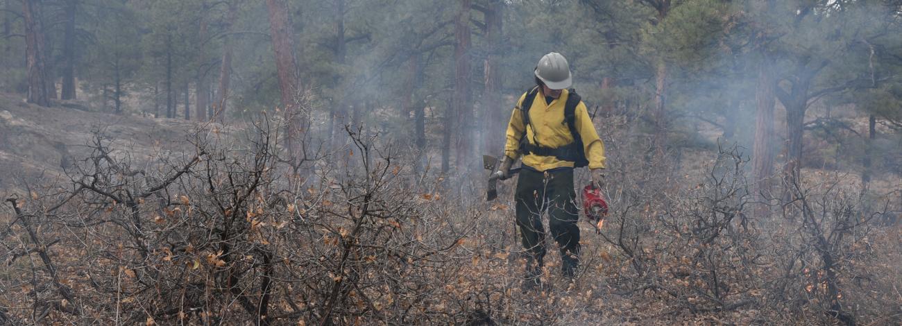
Prescribed fire is a planned fire. A prescribed fire is one of the most important tools used to reduce wildfire risk to communities, restore habitats, and to achieve land-management objectives. Fire management specialists consider objectives such as public and employee safety, weather, topography, fuels, size, the precise environmental conditions under which it will burn, and conditions under which it may be suppressed.
Prescribed fire is generally less expensive and yields ecological benefits that cannot be achieved by other means, such as mechanical thinning or logging. Prescribed fires restore some of the ecological benefits that were historically gained from naturally occurring fires. There are many potential goals that can be achieved by using prescribed fire. Here are a few examples:
- Reduce surface and ladder fuels that contribute to increased risk of uncharacteristically severe wildfire.
- Reduce risk local communities from wildfire.
- Help protect natural resources such as timber and critical habitat.
- Promote native species and reduce encroachment of invasive species.
- Enhance landscape resiliency and recovery from a wildfire event.
- Improve firefighter ability to safely and effectively respond to and suppress wildfire.
Prescribed Fires by District
All prescribed burns are carefully planned and only carried out when weather, fuel conditions, and air quality are within safe parameters. Firefighters use a combination of natural features and constructed control lines to keep the fire contained, with protocols in place to minimize smoke impacts on nearby communities.
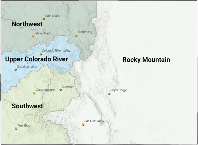
- Northwest District
October 21, 2026 Update: The U.S. Wildland Fire Service and Bureau of Land Management are preparing for prescribed pile burning operations in northwest Colorado as weather, fuel, and air quality conditions allow. Burning could begin when at least two inches of snow have accumulated, with operations potentially continuing through March 2027.
An overview of each fire is provided below. Read the full news release for more information. Find detailed information about each prescribed burn by searching Inciweb by unit/pile area name.
Little Snake Field Office
Petersen/Holland Draw Phase II
Approximately 12 acres of hand piles created in 2022 on BLM-managed public lands, located about 65 miles west of Craig in the Douglas Mountain area.
Petersen/Holland Draw Phase III
Approximately 108 acres of hand piles were created in 2024 in the same general area as above. Smoke may be visible from the communities of Greystone and along Highways 318 and Hwy 40.
Juniper Mountain
Approximately 5 acres of remaining hand piles located about 25 miles west of Craig and 5 miles southeast of Maybell. Smoke may be visible from Hwy 40.
Emerald Mountain
Approximately 112 acres of hand piles created in 2025 on BLM-managed public lands in partnership with the Colorado State Forest Service, located about 6 miles south/southwest of Steamboat Springs Airport in the Emerald Mountain area. Smoke may be visible from the communities of Milner and Steamboat Springs.- Rocky Mountain District
No prescribed fires are planned at this time.
- Southwest District
October 21, 2026 Update: The U.S. Wildland Fire Service continues prescribed fire operations throughout southwest Colorado as weather, fuel, and air quality conditions remain favorable. Following broadcast burning earlier this fall, crews are now preparing for pile burning operations that may continue into the winter months. Potential burn locations include areas within the Bureau of Land Management’s Uncompahgre, Gunnison and Tres Rios field offices and the Bureau of Indian Affairs’ Southern Ute Agency.
An overview of each fire is provided below. Read the full news release for more information. Find detailed information about each prescribed burn by searching Inciweb by unit/pile area name.
Uncompahgre Field Office
Norwood Rim / Norwood Piles RX | View map
Approximately 150 acres of hand piles are created for hazardous fuels reduction and Wildland-Urban Interface (WUI) protection. The project consists of two units located near County Roads 44Z and 44.5Z, approximately 2 to 3 miles northeast of Norwood, Colorado. Smoke may be visible from Norwood and surrounding areas.Gunnison Field Office
Gray Ranch Piles | View map
Approximately 46 acres of hand piles located in the Gray Ranch area of Gunnison County. The project area is approximately 25.6 miles southwest of Gunnison, 5.2 miles southwest of Powderhorn, and 15.2 miles northeast of Lake City. Located approximately 3.6 miles south of Highway 149, adjacent to Indian Creek Road (BLM Road 3033), and approximately 3.2 miles north of the Powderhorn Wilderness, these piles were created in mixed-conifer vegetation. Smoke may be visible from Highway 149, Powderhorn, and surrounding areas.Tres Rios Field Office
Dawson Research Piles | View map
Approximately 530 acres consisting of roughly 2,500 hand piles located in Disappointment Valley. These piles were created as part of a pinyon-juniper research project. Smoke may be visible from surrounding areas within Disappointment Valley.
West Rim Piles | View map
Approximately 60 machine piles are located along the West Rim of the Dolores River. The piles were created as part of a fuel break constructed during the Ferris Fire. Smoke may be visible from portions of the Dolores River corridor and adjacent areas.
Durango Piles | View map
Approximately 171 acres of hand piles in two treatment units near Durango. The Chelsea Unit includes approximately 96 acres and 200 piles, while the Skyline Unit includes approximately 75 acres and roughly 400 piles. These piles were created as part of hazardous fuels reduction treatments in the Durango area. Smoke may be visible from Durango and surrounding communities.
Grassy Piles | View map
Approximately 410 acres consisting of roughly 900 machine piles located adjacent to the Forest Lakes subdivision. These piles were created as part of a hazardous fuels reduction project. Smoke may be visible from Forest Lakes and nearby portions of Highway 160.
Yellowjacket Piles | View map
Approximately 13.5 acres consisting of roughly 200 hand piles within the McElmo Creek floodplain in Canyons of the Ancients National Monument. These piles were created as part of an invasive tamarisk removal project. Smoke may be visible from the Yellow Jacket area and portions of the national monument.County Road 225 Piles | View map
Approximately 110 acres of ongoing cut-and-pile treatments west of Durango. The Bureau of Land Management and U.S. Forest Service expect to construct between 500 and 1,500 hand piles before the end of winter. Smoke may be visible from County Road 225 and surrounding areas if pile burning occurs this season.Southern Ute Indian Tribe
Youth Camp Hand Piles
Approximately 40 acres of hand piles located near U.S. Highway 160 and County Road 175, west of Chimney Rock National Monument. Piles consist primarily of ponderosa pine, oak brush, and juniper slash generated from hazardous fuels reduction treatments. Smoke may be visible from Highway 160 and the Chimney Rock area.
Hall Canyon Hand Piles
Approximately 43 acres of hand piles located near County Road 700 and U.S. Highway 160. Piles consist primarily of ponderosa pine and juniper slash generated from forest thinning projects. Smoke may be visible from Highway 160 and surrounding areas.
Madrid Hand Piles
Approximately 40 acres of hand piles are located near the Navajo River in the Madrid area. Piles consist of ponderosa pine, mixed conifer, aspen, and Gambel oak material generated from forest management activities. Smoke may be visible from surrounding travel corridors and nearby communities.
Sundance Machine Pile
Approximately 10 acres consisting of a large machine pile located near County Road 518 on Southern Ute tribal lands. The pile is composed of oak, pine, cottonwood, and other woody material generated from Sundance and Bear Dance site maintenance activities. Smoke may be visible from nearby portions of County Road 518 and surrounding areas.- Upper Colorado River District
No prescribed fires are planned at this time.