


California Prescribed Fire
Fire has always been part of the environment, and one of the most important natural agents of change. Fire plays a vital role in maintaining healthy ecosystems. Native Americans understood this and used fire to hunt game, maintain rangelands, and keep forests healthy.
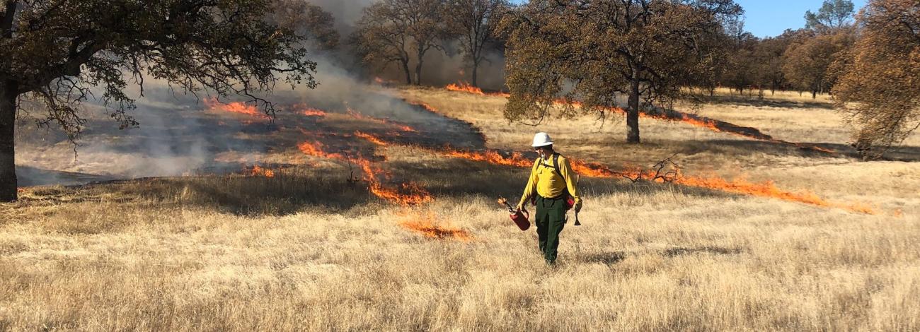
Prescribed fire is a planned fire. A prescribed fire is one of the most important tools used to reduce wildfire risk to communities, restore habitats, and to achieve land-management objectives. Fire management specialists consider objectives such as public and employee safety, weather, topography, fuels, size, the precise environmental conditions under which it will burn, and conditions under which it may be suppressed.
Prescribed fire is generally less expensive and yields ecological benefits that cannot be achieved by other means, such as mechanical thinning or logging. Prescribed fires restore some of the ecological benefits that were historically gained from naturally occurring fires. There are many potential goals that can be achieved by using prescribed fire. Here are a few examples:
- Reduce surface and ladder fuels that contribute to increased risk of uncharacteristically severe wildfire.
- Reduce risk local communities from wildfire.
- Help protect natural resources such as timber and critical habitat.
- Promote native species and reduce encroachment of invasive species.
- Enhance landscape resiliency and recovery from a wildfire event.
- Improve firefighter ability to safely and effectively respond to and suppress wildfire.
Prescribed Fires by District
All prescribed burns are carefully planned and only carried out when weather, fuel conditions, and air quality are within safe parameters. Firefighters use a combination of natural features and constructed control lines to keep the fire contained, with protocols in place to minimize smoke impacts on nearby communities.
- Northern California District
Lassen County, California
Timeframe: Beginning as early as Oct. 1 and continuing through fall, winter, and spring as weather and conditions allow.
Location: Understory broadcast burns will occur north of Eagle Lake at Bald Hills and Heavey Mountain, with smoke possibly visible near Stones Landing and Spaulding and along State Route 139, County Route A-1 (Eagle Lake Road), and Termo Grasshopper Road. Pile burns will occur at North Horse Mountain near Ravendale, with smoke possibly visible near Horse Lake and Ravendale and along Highway 395 and Horse Lake Road.
Read announcement for more details
Northeastern California and Northwestern Nevada
Timeframe: Beginning as early as Oct. 1 and continuing through fall, winter, and spring when adequate moisture is present.
Location: Pile burns will occur in Modoc County, northern Washoe County, and northeastern Lassen, Shasta, and Siskiyou counties. Smoke may be visible near Madeline, Likely, Alturas, Fort Bidwell, Cedarville, Fall River Mills, Tulelake, Dorris, and Macdoel, California, and to motorists in the Vya area of northwest Nevada.
- Central California District
No prescribed fires are planned at this time.
- California Desert District
No prescribed fires are planned at this time.