


Castle Gardens Petroglyph Site | Wyoming
The Castle Gardens Petroglyph Site is located in central Wyoming approximately 45 miles east of Riverton.
PLEASE NOTE: There are no restroom facilities onsite.
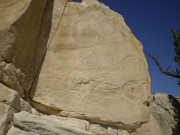
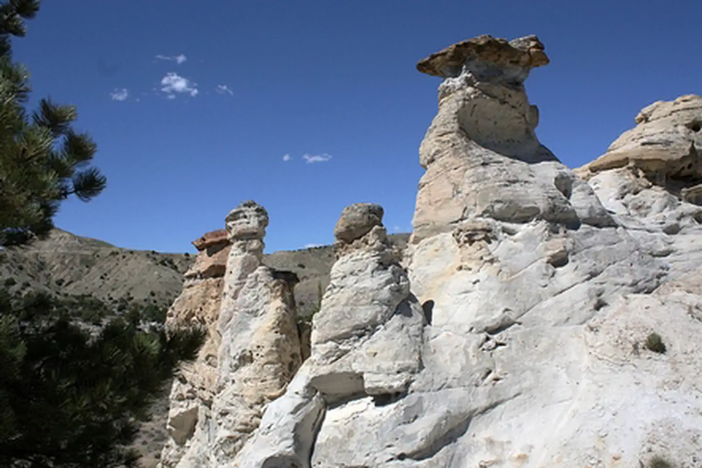
The name of the area comes from the outcropping of sandstone which the wind has eroded into fanciful shapes resembling the turrets and towers of castle. This unusual formation has been luring visitors for thousands of years, and many of them left their mark in the soft sandstone--the area holds a treasure of Native American rock art, or petroglyphs.
Improvements to the site have been made over the past several years to enhance the experience and to better protect the petroglyphs. A fine crushed gravel walking trail exist throughout the site, foot bridges to ease the crossing of deep drainages and a new parking area.
Future work at Castle Gardens will include new interpretive panels and benches for enjoying the view. All of these improvements are designed to reduce the amount of vandalism through increased understanding of the site and better visitor facilities.
The road is somewhat rough most of the year, especially the county road section of the Casper route, so high-clearance, four-wheel-drive vehicles are recommended.
Photos
Accessibility Description (ABA/ADA)
This site has limited cell phone reception, no potable water, and no toilets.
Parking for the site is on a packed dirt and gravel loop, about 40 feet wide and 200 feet long. A gravel path leads from the parking area to an entrance gate, with a kiosk just inside. The partially covered kiosk contains a site map and historical and cultural information about the petroglyphs.
The entrance gate marks the start of a compacted-gravel trail that winds through the site to the petroglyphs. It is a 1-mile trip to the petroglyphs and back, on a trail with an average grade of 5 percent (the maximum grade is 16 percent). Trail widths range from 5.5 feet, in most sections, to 3.5 feet on the 3 wooden bridges. There are 5 benches without arms along the trail. Because of its slope and surface, some visitors with limited mobility may find sections of the trail challenging.
Six areas with petroglyphs are fenced off, but the images are visible from a sitting position.
Descriptions and photos uploaded November 2026. Please note that actual on-the-ground conditions may vary due to natural events (e.g., weather, wildfires, erosion), normal wear and tear, or site improvements.
CASTLE GARDENS PETROGLYPH SITE PHOTOS

Contact Us

Activities


Addresses
Directions
From Casper, Castle Gardens can be accessed by taking U.S. Hwy. 20/26 78 miles west to Castle Garden Rd just before Moneta. Take a left at the Castle Gardens sign and drive approximately 15 miles south. You will reach another BLM sign that directs you east for another 6 miles to Castle Gardens. From Riverton, take Wyoming State Hwy. 136 east for approx. 38 miles, then turn north on to Castle Gardens Rd and head north for 6 miles. You will reach another BLM sign that directs you east 6 miles to Castle Gardens. The road is somewhat rough most of the year, especially the county road section of the Casper route, so high-clearance, four-wheel-drive vehicles are recommended.
Fees
No fees.